 Alaungdaw Kathapa National Park
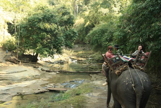
The Alaungdaw Kathapa National Park, with an area of 1,605 square kilometers, is the largest national park inBurma (Myanmar). The park consists of the Patolon Reserved Forest and the adjoining Taungdwin Reserved Forest.HistoryThe Patolon Forest Reserve was originally established on 21 July 1893 and was enlarged in 1917. The Taungdwin Reserved Forest was established effective 1 December 1893. In 1941, Taungdwin was made into a wildlife sanctuary by the British colonial government, and it was upgraded to a national park in 1984 by the Burmese government.EtymologyThe national park was named after a shrine to one of Buddha’s saintly disciples, Maha Kathapa (Maha Kassapa). This shrine dedicated to Alaungdaw Kathapa (literally, the embryo-Kathapa) is located inside the park boundaries. The shrine has a reclining figure called Kathapa and it is believed that his remains are kept under the shrine.TopographyThe national park includes the upper catchment basins of the Petpa, Patolon and Taungdwin rivers. The Petpa River is a tributary of the Patolon. The Patolon and Taungdwin rivers drain the eastern and western parts of the park, respectively. These rivers are north flowing in steep sided valleys separated from each other and from adjoining valleys to the west and east by long north-south ridges that rise to elevations from 2000 to over 4000 feet. These parallel ridges are a series of cuestas, characterized by fairly steep escarpments on the eastern face with a moderate slope on the west.The prominent ridge known as Mahudaung is the easternmost ridge in the park, and it forms the watershed between the broad settled valley of the Chindwin and the Patolon and the Petpa drainages to the west. Further west beyond the Taungdwin River, another high ridge, the Ponnyadaung, reaches a height of 4263 feet at Hlaingma Taung, and forms the western boundary of the park.In the rainy season, numerous small waterfalls appear above the valleys, especially along the upper reaches of the Patolon and Petpa rivers. In the dry season, March through May, many of the smaller streams dry up. There are a number of perennial springs that keep the major rivers flowing.FloraSagaing Division lies at the north of Myanmar's temperate dry zone. The Alaungdaw Kathapa National Park comprises two biomes : Temperate broadleaf and mixedand temperate coniferous forests.The forests which exist in the national park are specialized as -
Credit: အေလာင္းေတာ္ ကႆ ပ ခရီးသြားလမ္းညႊန္ေပ့ခ်္မွ/ |
Authorဒီစာမ်က္ႏွာေလးက ကၽြန္ေတာ္ခ်စ္တဲ့ ၿမိဳ႕ကေလး အေၾကာင္း စုစည္းမႈေလးပါ။ သတင္းဓာတ္ပံုမ်ား၊ အခ်က္အလက္မ်ားကို ArchivesCategories |
 RSS Feed
